Map the City
Structured 1,700+ municipal recreation records with geocoded coordinates, council districts, and facility amenities.
I reused the operational database from PlayLA Flag Football Operations to power a mobile-first public resource: turning structured records into search, program cards, and pre-loaded Google Maps directions for the 15 active locations available to families now.
In PlayLA Flag Football Operations, I structured the civic infrastructure: mapping 1,700+ PlayLA locations with addresses, ZIP codes, linked feeder schools, and geocoded coordinates. That database did not stay trapped inside administrative back-offices; it became reusable infrastructure for this public web resource.
The public application transforms raw operational data into an intuitive family resource: active program cards, interactive rules, equipment specifications, bilingual English and Spanish access, and game-day safety checklists. The primary product enhancement is frictionless routing: clicking any facility card opens Google Maps with turnkey navigation already calculated directly to the recreation center.
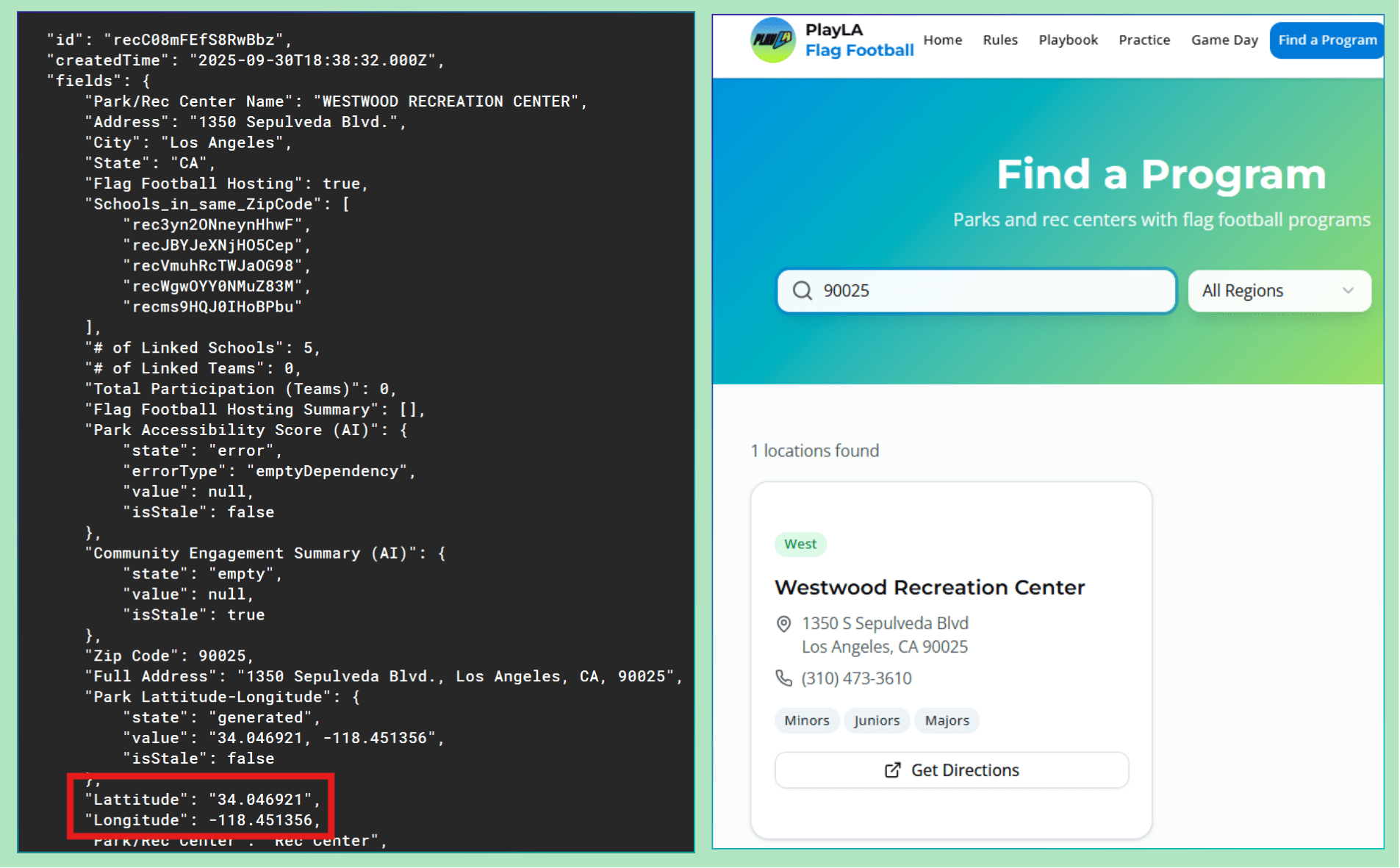
The left side illustrates the Westwood Recreation Center record from the 1,700+ location database, including geocoordinates and district boundaries. The right side shows that same structured record rendered as a parent-ready Find a Program result for one of the 15 active locations.
The application translates coordinates and street addresses into direct Google Maps directions with the route already calculated, saving busy families multiple clicks during game-day transit.
Comprehensive orientation covering practice schedules, player safety, volunteer coaching contacts, and venue protocols to establish community trust.
Accessible equipment checklists and uniform guidelines with persistent language toggling, ensuring equitable access across Los Angeles communities.
Mobile interactive checklists for volunteer coaches with direct-dial links to city park maintenance, local emergency contacts, and first aid guidance.
Community ecosystem connecting the City of Los Angeles Department of Recreation and Parks, LA28 Olympic committee, and professional sports franchises.




Static deployment on modern cloud architecture delivers fast, sub-second load times on mobile devices under erratic park cellular connections.
Structured 1,700+ municipal recreation records with geocoded coordinates, council districts, and facility amenities.
Filtered the operational database to power dynamic search and program cards for 15 active seasonal clinic locations.
Automated deep-link generation so tapping a location opens Google Maps with turnkey navigation already calculated.
Packaged bilingual parent guides, safety protocols, emergency dispatch numbers, and digital coach checklists.
Community and consumer web applications encounter severe friction when organizations treat front-facing interfaces as separate from internal operations. When data is re-entered by hand, information drifts, addresses become stale, and user trust dissolves.
By connecting the PlayLA public web app directly to our relational operational schema, we eliminated manual synchronization and gave thousands of families instant access to directions, game schedules, and bilingual guidance. In enterprise systems, this principle is universal: user experiences are only as dependable as the data architecture beneath them.








I bring an Olympic athletic background to fuel the relentless discipline required to execute, a deep research background focused on hyper-targeted strategy, and the grit of the immigrant experience. I rely on hard analytics and behavioral strategy to build resilient operational systems that help businesses actually run.